Drones in the Construction Industry: Uses, Rules and Costs in 2026
What's new: Unsourced figures replaced with BLS safety data, EU and US rules (incl. FCC limits on new foreign drones) and pricing; new sections on costs, docks and data; Intelvision's role corrected to software.
Summarize with AI
Read summarized version with AI
- Drones now support every construction phase, from surveys and earthworks volumes to progress tracking, inspections and as-built checks.
- Safety is the clearest case: falls, slips and trips caused 389 of 1,034 US construction deaths in 2024, and drones cut time spent at height.
- In the EU, open-category flights stay below 120 m with class-marked drones; BVLOS, heavy drones and many urban sites need the specific category. US flights fall under Part 107, and new foreign-made drone models face FCC authorization limits since December 2025.
- Hardware is only part of the cost: software such as DroneDeploy (USD 4,188 a year) or PIX4Dmatic (from USD 125 a month), trained pilots, compliance and data integration add up.
- The hardest part is the data: drone outputs pay off when they reach the BIM model, schedule and cost systems where decisions are made.
Not long ago, drones were mostly military hardware. Today they map sites, inspect roofs and facades, measure stockpiles, document progress and even fly over Mars. On construction sites they have become a routine survey and monitoring tool, and the questions have moved on from "should we try drones?" to "which drone, under which rules, and what do we do with all the data?"
We first published this article in 2022. This 2026 version keeps the original's view of where drones help on site and updates everything around it: current use cases, drone types and sensors, the EU and US rules for flying over a construction site, what a drone program costs, how to choose between an in-house program and a service provider, and why the real work starts after the drone lands.
How drones improve construction site safety and efficiency
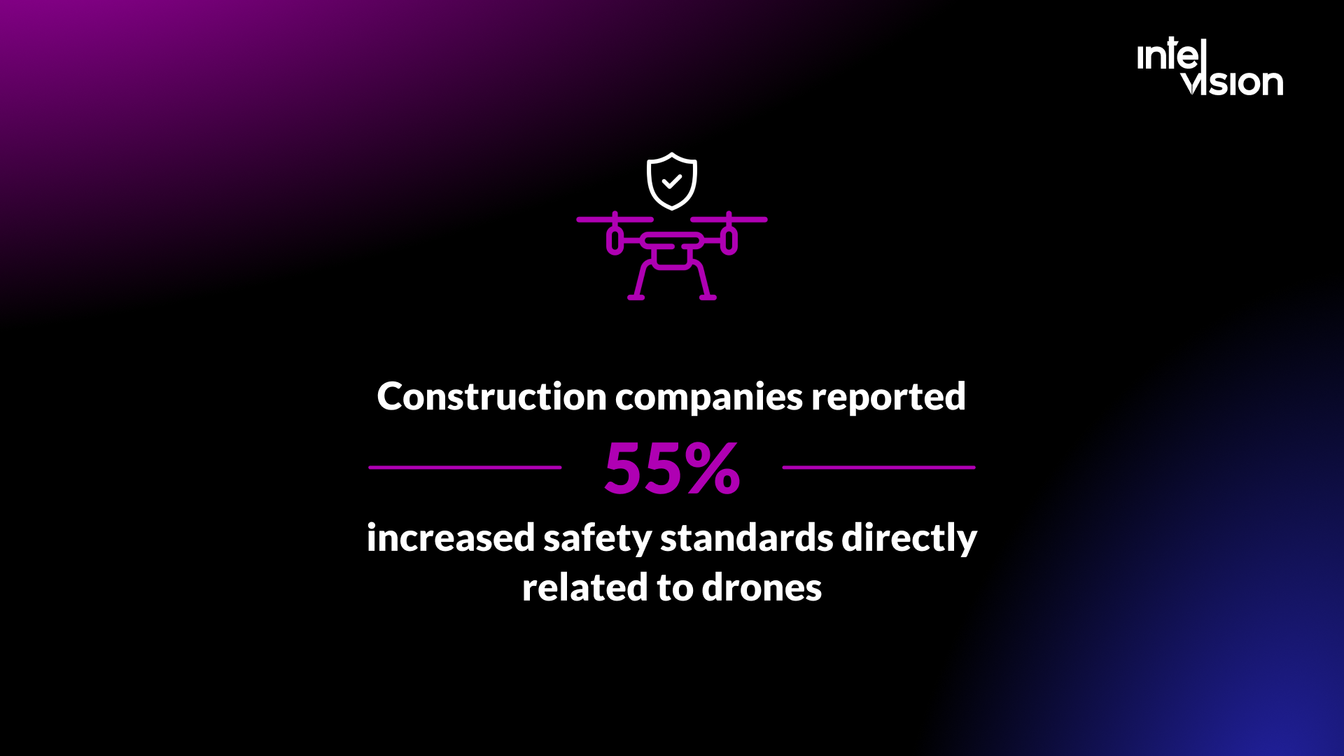
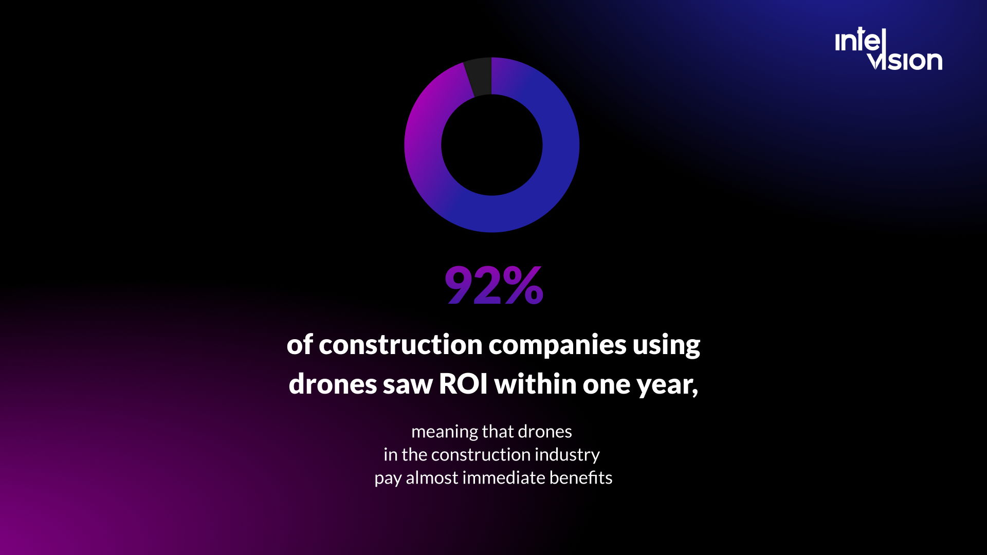
Construction was one of the first industries to adopt commercial drones at scale. In a 2018 survey of 1,736 people by Blue Research for Skyward, construction and engineering had the highest adoption rate of any sector at 35%, and 92% of respondents said their company saw a positive return on its drone investment within a year. The top obstacle they named was keeping up with laws and regulations. Both findings still hold: drones pay back quickly when they replace slow, risky manual work, and the rules are the part most teams underestimate.
Safety is the clearest case. Falls kill more construction workers than almost anything else: of the 1,034 workplace deaths in US private-sector construction in 2024, 389 were due to falls, slips and trips, and 95.9% of those were falls to a lower level, according to the Bureau of Labor Statistics. Every roof, facade, bridge deck or stockpile that is measured or inspected from the air instead of by a person on a ladder or a harness removes some of that exposure.
Efficiency is the other. Drones collect in minutes data that a survey crew needs hours or days to gather, and they collect it the same way every time, which makes week-on-week comparisons possible.
How drones are used across the construction lifecycle
Drones are now used at every stage of a project, from site selection to handover and maintenance. Typical uses by phase:
| Phase | What drones do | Typical output |
|---|---|---|
| Site selection and planning | Survey terrain and natural conditions, check access and surroundings | Orthomosaic map, terrain model, site photos |
| Design | Provide an accurate existing-conditions model for designers | Point cloud, digital surface model, contour lines |
| Earthworks | Measure cut and fill against the design surface, track volumes | Volume reports, cut and fill maps |
| Construction | Document progress, track equipment and materials, monitor safety | Weekly maps and 3D models, progress reports, issue photos |
| Quality and inspection | Inspect roofs, facades and structures, compare as-built to the model | Inspection images, thermal data, deviation reports |
| Handover and operations | Provide as-built records and support maintenance inspections | As-built model, asset inspection history |
| Marketing | Capture aerial photo and video of the finished project | Images and video for sales |
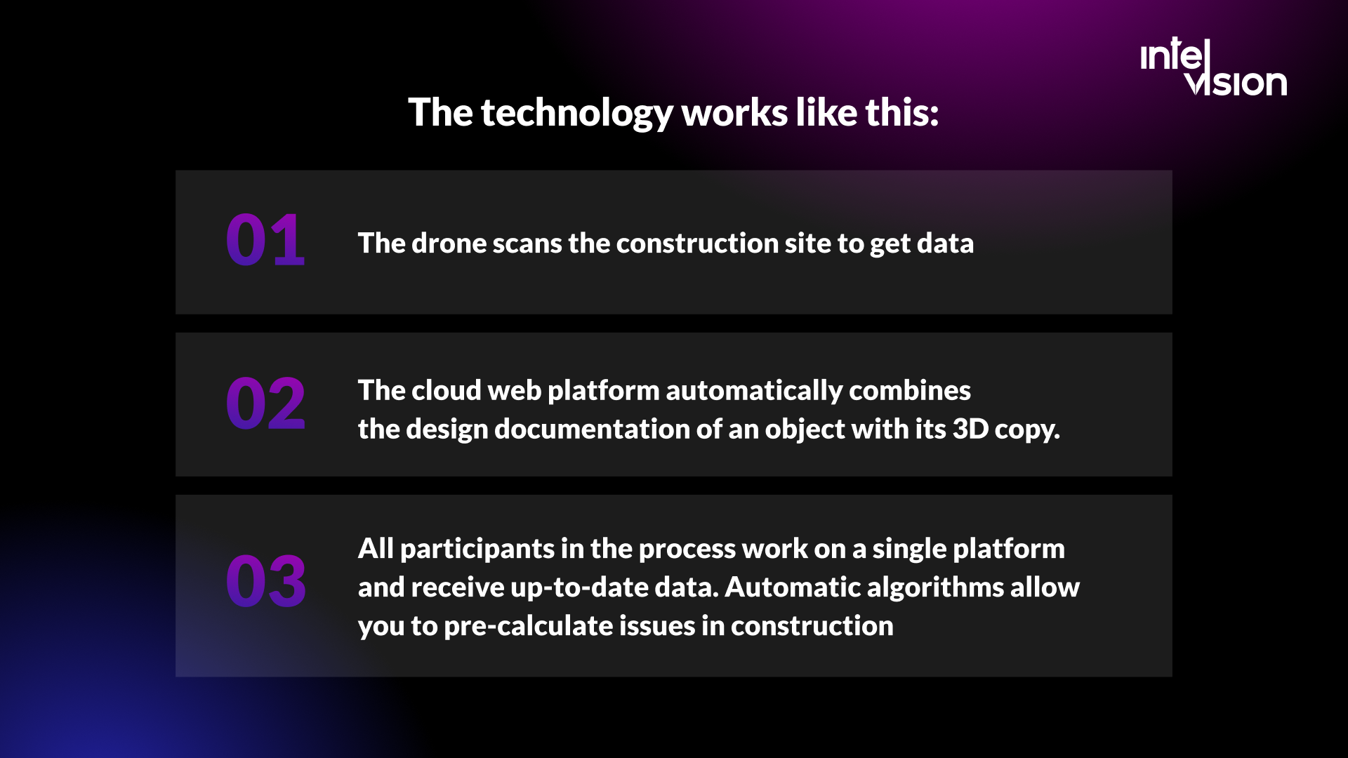
The value comes when drone data reaches a shared platform. The workflow is the same in most companies:
- The drone flies a planned mission and captures images, LiDAR or thermal data.
- Processing software turns the raw data into maps, point clouds and 3D models, often in the cloud.
- The platform overlays the model on the design or BIM model and the schedule, so deviations and progress are visible.
- Everyone involved, from site managers and engineers to the owner, works from the same up-to-date data, and automated checks flag issues before they become rework.
7 ways drones are changing construction
Construction has long been slow to adopt digital technology, even though the long-term benefits are significant. Drones are one of the technologies that crossed over into everyday use. Here is where they make the most difference.
1. Faster, safer surveying
Topographic surveys that once took a crew several days can be flown in hours. With RTK positioning, an enterprise drone such as DJI's Matrice 4E reports positioning accuracy of 1 cm + 1 ppm horizontally and 1.5 cm + 1 ppm vertically when RTK is fixed (DJI Matrice 4 specs). Survey-grade results still depend on ground control, flight planning and processing, so treat drone surveys as a tool for surveyors, not a replacement for them.
2. Earthworks and stockpile measurement
Volume calculations for cut and fill or stockpiles are among the fastest paybacks. Instead of estimating, the site team gets a measured volume on a regular schedule and can compare it to the design surface. That improves payment checks with earthworks subcontractors and material ordering.
3. Progress monitoring and reports
Drones produce consistent aerial views that let clients, owners and managers see progress without being on site. Repeated flights over the same route create a visual record of the whole project, which is also useful evidence in disputes. Platforms such as DroneDeploy now combine aerial imagery with interior 360 walkthroughs and use AI to turn them into progress reports, and they sync with Procore and Autodesk (DroneDeploy).
4. Effective equipment tracking
With a quick flyover, a manager can check whether equipment is where it should be, and spot rented machinery that should already have gone back, avoiding expensive extension charges.
5. Increased personnel safety
Drones reduce the time people spend at height and in hazardous areas. Managers use drone cameras to review the site for safety issues such as missing edge protection, blocked access routes or unsafe material storage. Some platforms now detect common safety risks automatically from imagery, for example DroneDeploy's Safety AI add-on, which it describes as detecting OSHA risks.
6. Inspections of roofs, facades and structures
Close-range inspections of roofs, facades, bridges and tall structures are faster and safer from the air. Thermal cameras reveal moisture, insulation gaps and electrical hot spots. In the US, Part 107 even allows drones to fly higher than the usual 400 feet when they stay within a 400-foot radius of a structure and no more than 400 feet above its top, which suits tall building inspections (14 CFR 107.51).
7. As-built comparison and less waste
Comparing drone-captured models with the design or BIM model catches deviations early, while they are still cheap to fix. Fewer errors mean less rework and less waste, and accurate quantities mean fewer over-orders.
Types of drones used in construction
Every task and every site needs the right aircraft and the right sensor. These are the main types construction companies use.
Multirotor drones
Multirotor drones take off vertically like a helicopter and are stable and maneuverable, which makes them the default for construction sites. They usually have four to eight rotors, depending on the stability and payload needed. Their weakness is endurance: battery capacity limits flight time, so they suit sites and structures more than corridors many kilometers long. Current enterprise models fly longer than they used to: DJI lists a maximum flight time of 49 minutes for the Matrice 4 series with standard propellers, measured without payload and without wind, so plan on less in real site conditions.
Fixed-wing drones
Fixed-wing drones look and fly like small airplanes, generating lift as air flows over the wings. They fly much longer and cover large areas efficiently, which makes them useful for corridor projects such as roads, railways and pipelines, and for large sites. They need more skill to operate and space or a launcher to take off and land, and they cannot hover for close inspection.
Single-rotor helicopter drones
Helicopter drones have one main rotor, which gives longer flight times and more efficient energy use than multirotors and can carry heavier sensors. They are harder to fly, and with only one main rotor, small imbalances or collisions can quickly make them unstable. They are rare on building sites.
Fixed-wing hybrid (VTOL) drones
Hybrid drones take off and land vertically like a multirotor, then cruise on wings like an airplane. They combine the endurance of fixed-wing aircraft with the flexibility of vertical take-off, which makes them a good fit for large infrastructure surveys where there is no runway.
Drone-in-a-box systems
The newest category is the docked drone that lives on site in a weatherproof station, charges itself and flies scheduled missions remotely. DJI's Dock 3, for example, charges its drone from 15% to 95% in 27 minutes, is rated IP56, operates from minus 30 to 50 °C and lists a maximum operating radius of 10 km in ideal conditions (DJI Dock 3 specs). Skydio offers a dock for its X10, which it describes as operating from 1 ft to 400 ft with visual and radiometric thermal sensors, designed, assembled and supported in the USA (Skydio). Docks make daily progress capture possible without a pilot on site, but remote operations usually need additional regulatory approval. In the US, also check the FCC restrictions on new foreign-made drone models described in the rules section below.
Sensors matter as much as the aircraft
- RGB cameras for photogrammetry: maps, 3D models and progress photos.
- LiDAR for terrain under vegetation and for dense, accurate point clouds.
- Thermal cameras for roof, facade and electrical inspections.
- RTK or PPK positioning for survey accuracy with fewer ground control points.
Drone rules for construction sites in 2026
Legislation began adapting to drones in the mid-2010s. Today, both the EU and the US have stable frameworks, and most routine construction flights fit within them. The details decide whether a flight is routine or needs an authorization.
European Union
- Open category: for low-risk flights, drones must stay below 120 m above ground level. Subcategories A1, A2 and A3 depend on the drone's class mark and how close it flies to uninvolved people; in A3, for example, the drone must keep 150 m from uninvolved people and urban areas (EASA open category).
- Class marks: the C0 to C4 class identification labels have applied since 1 January 2024. Drones without a class mark can be used in the open category only if they were placed on the market before 31 December 2023.
- Registration, training and Remote ID: operators of drones from C1 upwards, and of lighter drones with a camera that are not toys, must register, pilots need online training and, for A2, an additional theory exam, and almost all drones must broadcast a remote identification.
- Specific category: needed for flights beyond visual line of sight, above 120 m, with drones over 25 kg, when dropping material, or in urban environments with drones over 4 kg or without a class label. Routes include a declaration under a standard scenario, or an operational authorisation through a predefined risk assessment or a SORA (EASA specific category).
Construction sites in towns and cities often fall into the specific category, or into A2 with a C2 drone, because of the distances to uninvolved people. Check the site and the flight plan, not only the drone.
United States
- Commercial flights fall under Part 107, and the pilot in command needs a remote pilot certificate with a small UAS rating (14 CFR 107.12).
- The drone must stay within visual line of sight of the pilot or a visual observer throughout the flight (14 CFR 107.31), and below 400 feet above ground, except near structures as described above.
- Flights beyond visual line of sight and over people need to meet specific rules or obtain a waiver; both are on the list of waivable sections (14 CFR 107.205). The FAA proposed a dedicated BVLOS rule, Part 108, on 7 August 2025, which would replace case-by-case waivers with performance-based rules (DLA Piper summary). Check whether it is in force before you plan BVLOS work around it.
- Hardware choice is now a regulatory question too. In December 2025 the FCC added foreign-produced drones and critical components to its Covered List, which bars new models from makers such as DJI and Autel from FCC authorization. Previously authorized models can still be used and sold (Inside Unmanned Systems). If you are building a fleet in the US, confirm that the models you plan to buy are authorized.
Privacy and site data
Drone images often capture people, neighboring properties and vehicles. In the EU and the UK, images of identifiable people are personal data, so a drone program needs a lawful basis, a retention policy and controls on who can see the footage. Construction clients increasingly also set their own rules on where site imagery is stored and which vendors may process it. Agree on both before the first flight.
What a construction drone program costs
An impressive list of expenses can put off a business owner, so it helps to break the budget down. A drone program has five cost blocks:
| Cost block | What it covers | Published price examples |
|---|---|---|
| Hardware | Drones, batteries, sensors, RTK base, docks | Quoted by dealers; docks and LiDAR payloads are the largest items |
| Flight and processing software | Mission planning, photogrammetry, volumes, models | DroneDeploy Flight & Analysis: USD 4,188 a year; PIX4Dmatic from USD 125 a month; PIX4Dmapper from USD 333 a month (Pix4D pricing) |
| Team and training | Certified pilots, training time, data processing staff | Internal cost |
| Compliance and insurance | Registration, authorizations, liability insurance | Varies by country and operation |
| Integration and data | Storage, BIM and project platform integration, dashboards | Enterprise software plans are quoted individually |
Hardware is only one part of the budget, and often not the largest. The other big costs are people, software subscriptions and the effort to get drone data into the systems where decisions are made. Enterprise and team plans from the main platforms, including DroneDeploy's construction plans and add-ons such as Progress AI and Safety AI, are priced by quote.
To build the business case, compare the program's annual cost against what it replaces: survey days, inspection access equipment such as lifts and scaffolding, time spent on site visits, rework caught early and disputes avoided. Projects with frequent earthworks or many sites usually justify an in-house program; occasional needs are usually cheaper to buy as a service.
In-house drone program or drone service provider?
| In-house program | Drone service provider | |
|---|---|---|
| Best for | Many sites, frequent flights, standard deliverables | Occasional surveys, specialist work such as LiDAR or complex authorizations |
| Upfront cost | Hardware, software, training | None; pay per flight or per project |
| Speed | Fly whenever needed | Depends on the provider's schedule |
| Data ownership | Fully yours, in your systems | Agree on formats, ownership and delivery in the contract |
| Compliance | Your responsibility | The provider's responsibility for flights |
Many firms combine the two: an in-house pilot or a docked drone for routine progress capture, and a specialist provider for survey-grade or LiDAR work.
From flights to decisions: the data problem
Companies soon realize that the biggest challenge is not the drone. It is how to collect, store, manage, interpret and analyze the volumes of data that drones generate. Captured data is stored on the drone's memory card or streamed from a dock, uploaded to the cloud, and processed into video, maps or formats suitable for BIM and other 3D applications. Then someone has to use it.
The common problems are predictable:
- Data lands in a silo. Maps and models sit in the drone platform while decisions are made in the project management system, the BIM model and spreadsheets.
- Nobody owns the comparison. A model is only useful when someone compares it with the design, the schedule and last week's flight.
- Files are huge. Point clouds and image sets need storage, retention rules and access control.
- Formats do not match. Coordinate systems, file formats and model versions must line up with the BIM and survey data.
The fix is to treat drone data as one input into a shared data environment, not as a separate product. Integrations between drone platforms and project tools such as Procore and Autodesk solve part of the problem. The rest is usually specific to the company: connecting drone outputs with the BIM model, the schedule, cost data and quality records, and presenting the result in dashboards people actually use. Our guides to the common data environment and construction data analytics cover that side in detail.
How to start a drone program: step by step
- Pick one or two use cases with clear value, for example weekly progress capture or earthworks volumes, and measure the current cost of doing them without drones.
- Check the rules for your sites: category, distances to uninvolved people, airspace restrictions and any authorization needed.
- Decide in-house or provider for each use case.
- Choose aircraft, sensors and software that match the use case and integrate with your project tools.
- Train and certify pilots, and write standard operating procedures: pre-flight checks, site communication, incident reporting.
- Define the data flow: where data is stored, who processes it, which systems receive it and how long it is kept.
- Run a pilot on one or two projects and compare results with the baseline.
- Scale to more sites and use cases, and automate what repeats, for example with docked drones.
Common mistakes with drones in construction
- Buying hardware before defining the use case. The drone is the easy part.
- Treating regulation as an afterthought. Urban sites, cranes and nearby airports change what is allowed.
- Flying without a data plan. Images nobody processes or compares are cost without value.
- Expecting survey accuracy without survey practice. Ground control, calibration and checks still matter.
- Not telling the site team. Workers need to know when and why drones fly, both for safety and for privacy.
- Ignoring client requirements. Owners may restrict which vendors and platforms can handle site imagery.
Drones complement the construction workforce, not replace it
Drones do not replace surveyors, site managers or inspectors. They take over the dangerous, repetitive data collection so those people can spend their time on judgment: interpreting deviations, coordinating trades and solving problems. Like earlier waves of automation, they also create new roles, from certified remote pilots to people who process and analyze site data and manage docked fleets. The companies that benefit most are the ones that train their existing teams to use drone data, not the ones that buy the most aircraft.
Where Intelvision fits in drone-based projects
Every business looks for ways to optimize and cut costs, and drones offer that opportunity in construction. To be clear about our role: Intelvision does not fly drones or sell drone services. We build the software around them, which is where most drone programs get stuck.
That includes integrations that move drone outputs into project, BIM and ERP systems, data platforms and dashboards that combine them with schedule and cost data, field apps for inspection workflows, and AI features that flag issues for people to review. Relevant published work from our construction, energy and utility clients:
- Visoplan, a German construction collaboration platform, needed to integrate multiple plugins, manage many file types and unify 3D models; our team grew from one engineer to five, with development costs cut by 50% and 40% faster time to market.
- A national utility company in the DACH region replaced paper-based field inspections with a GPS-enabled mobile app with offline capture and automatically generated compliance documentation, cutting inspection reporting time by 65%.
- A European renewable energy operator got a smart monitoring and alerting system across its solar and wind sites, with a 38% decrease in downtime in six months and 60% fewer on-site visits.
If your drone data is not reaching the people who make decisions, the next step is usually an integration project, not another drone.
The future of drones in construction
The direction for the next few years is clear from what vendors already ship. Docked drones will make daily, automated site capture normal on large projects. AI will turn imagery into progress percentages, safety alerts and deviation reports without manual review of every image. Drone data will feed digital twins that owners use long after handover. And as rules for flights beyond visual line of sight mature, drones will inspect long infrastructure such as roads, rail and power lines routinely.
Drones may become as common on construction sites as forklifts and cranes. When they are combined with good data practices, they will make the whole construction lifecycle faster, safer and better documented.
Sources
- Construction Dive (2018): 92% of firms using drones see ROI within one year
- BLS: National Safety Stand-Down highlights fall hazards in construction
- DLA Piper: FAA proposed Part 108 BVLOS rule
- Inside Unmanned Systems: FCC moves to block new foreign-made drone approvals
- DJI Enterprise: Matrice 4 series specs
- DJI Enterprise: Dock 3 specs
- Skydio: Autonomous drones and docks
- DroneDeploy: Pricing and plans
- Pix4D: Pricing
- EASA: Open category, low-risk civil drones
- EASA: Specific category, civil drones
- 14 CFR 107.12: Remote pilot certificate requirement
- 14 CFR 107.31: Visual line of sight aircraft operation
- 14 CFR 107.51: Operating limitations
- 14 CFR 107.205: List of regulations subject to waiver
Read Intelvision often? Add us as a preferred source in Google Search.
Add to preferred sources